Last time I visited England, Dave and I only managed an afternoon hike. During which he mentioned he had considered taking me for a walk round Windgather Rocks. The short 12m rock face is claimed to be one of the friendliest and most popular climbing crags in the Peak District. It has been a favourite for many people over the last hundred years, having an abundance of routes. Many lower grade lines means it is a great place to learn to lead climb. On trad of course, as bolts are an extreme rarity in the Peak District, although the climbs are at times a little run out:
In fact bolts are forbidden on gritstone, so only exist from historic placements of which there are very few indeed. Windgather Rocks comprises Chatsworth Grit, a carboniferous sandstone formed 300–360 million years ago. The a coarse-grained nature of this type of “grit” lends itself to even better friction if that is possible. This in part makes the location such a beginner-friendly crag. Why is all this relevant? Well Dave had hinted to being up for giving climbing a crack, and I found out he has many years back had a go at climbing at this very location:
In our favour his neighbour is an avid climber, and she was happy to lend us all the gear meaning I didn’t need to cart all my stuff over. While she questioned Dave about rock climbing in winter, in my days of climbing in England we climbed year round so knew what we may be up for condition wise. We had a date set and gear organised for the great adventure, however as the day approached and due to stuff that was happening in Dave’s life he confessed to not being in the right head space for climbing:
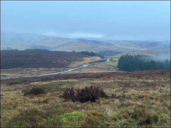
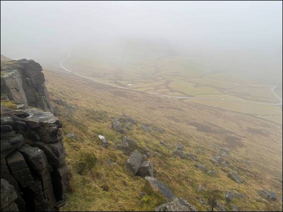
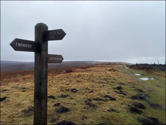
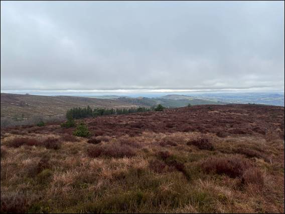
He was however still very keen to get out for a hike, to help blow the cobwebs away. Picking me up relatively early so we could get back just after lunch, we still headed to Windgather Rocks with the intention of hiking round part of the Goyt Valley. As with the first few days of country drives with my folks, the cloud hung low in the sky. Tendrils stretching down into, and being blown by a cold wind up, the valleys. Above we have just passed Cats Tor and ahead lay Shining Tor, at 40m higher and with its peak just about covered in clouds:
Shining Tor is the highest hill in the county of Cheshire, and on a good day 360 degree views stretch far and wide taking in the Clwydian Range in North Wales and The Wrekin in Shropshire, amongst other land marks. But not today. Being a weekday the area was quiet and we met very few people for the majority of the walk. On the hike up to Shining Tor only one local came past. He had a bit of chat in part as he spotted me picking up litter and was grateful for that. Mentioning that on a nice day the place is transformed with hundreds flocking here:
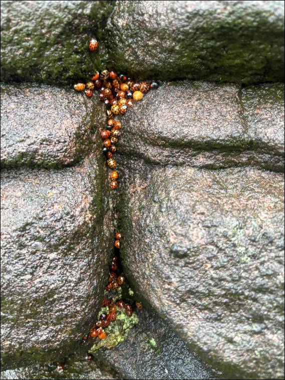
As I stood atop the short walls shown above, I spied more rubbish so went down to get it. Intending to also use it as an excuse to scramble back up the rocks. They were however green and slimy, so I erred on the better side of caution and didn’t attempt them. Making me think that it was a good thing that Dave had swayed today’s adventure from vertical ascents to those of a more gentle angle. I did however spot hundreds of Ladybirds (Coccinellidae). Such clusters are called a loveliness, and are used to stay warm and safe during hibernation:
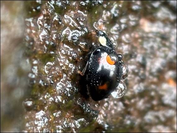
I’d never seen these clusters before. There were large groups of them in the cracks all over this rock, and it looked pretty amazing. There were also quite a few differing patterned and coloured ladybirds. I have now read that there are over 40 species in the United Kingdom, with 26 easily recognizable due to distinct features, and 5-6,000 worldwide. I could be wrong but the above may be a melanic (black) colour morph of the Harlequin Ladybird (Harmonia axyridis Var. Spectabilis), and kinda wish I had taken more images of the different sorts we saw:
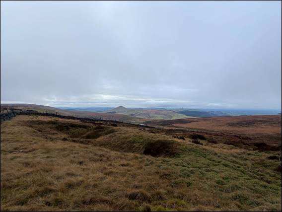
Above and looking west is Shutlingsloe, it is right on the edge of the Peak District and stands at 506 meters (1,660 feet). This particular peak has steeper sides than others and from the right direction, as I discovered on the last day out with the folks, it can resemble a distinct alpine style pyramid-shaped profile. This has earned it the local name of the “Matterhorn of Cheshire”, despite standing at only 11% of the height of the Matterhorn in the Swiss Alps. As we approached a T-junction in the path another prominent landmark came to view, this time an inn (or pub):
The Cat and Fiddle Inn was the second-highest pub in Britain at 515 meters (1,689 feet), so higher than the “Matterhorn of Cheshire”. But is pipped of the title by 13 meters (43 feet), by the Tan Hill Inn in Swaledale, North Yorkshire. The Cat and Fiddle Inn however closed down in 2015, and when it reopened in 2020 it became a distillery as opposed to a traditional pub. Unlike a couple of years back when Dave and I unsuccessfully changed course to head to the Snake Pass Inn, https://sandbagged.blog/2024/05/05/hard-yakka/, this time we were not tempted:
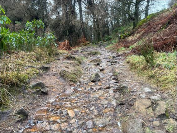
Instead we made our way down towards Errwood, taking a winding path through a wood and navigating long sections of the path that resembled a stream. This took us in a roundabout way, as we stumbled across tracks that took our fancy, to the Errwood Hall Burial Ground. Here the Grimshawe family and their favourite servants have been laid to rest. This now makes more sense, as Dave I wondered why some graves had stone headstones and others had iron crosses. The latter no doubt being for the favourite servants:
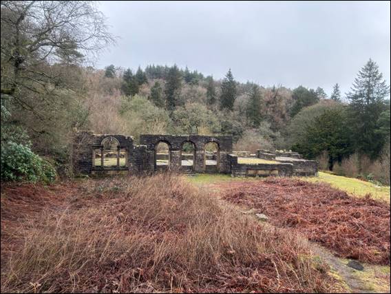
The Grimshawes owned the estate until 1930. It was then sold to the Stockport Corporation, who built the Fernilee and Errwood reservoirs in the 1930s and 1960s respectively, as key water supply sources. We were heading there next, but not before passing the remains of Errwood Hall. Once a stately 19th century mansion, completed in the 1830s in the centre of a 2,000 acre estate that included a private coal mine as well as the Cat & Fiddle Inn. After the death of the last resident in 1929, the hall was demolished in 1934:
Below are the only remnants of the mighty halls. Not being a formally listed building, they were able to modify what was left primarily due to safety risks. These obvious modification in part takes away from the feel of the place. It includes a shrine dedicated to a Spanish governess that taught the family’s children, and who is rumoured to haunt what is left of the house. Leaving the ruins behind we made our way down to the waterbodies, firstly the upper Errwood reservoirs. Completed in 1968 for a princely sum of £1,500,000:
And then onto Fernilee reservoir, completed in 1938 for a mere £480,000. Within this one there are several buildings, which includes the Chilworth Gunpowder Factory. Originally established in 1801 as the Fernilee Gunpowder Works, until it was taken over in 1888 by the Chilworth Gunpowder Company. It was operated until 1921. Closing down due to the consolidation, primarily in Scotland, and declining demand of gun powder post-World War I. And finally being laid to rest with most of the buildings being submerged underwater:
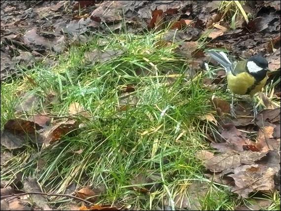
I’ve not mentioned any of the birdlife that we both heard and saw, which seemed to come alive more and more as we walked. Most species were mentioned in the above linked post, so the only one to crack a reference is the above Great Tit (Parus major). Obviously used to human contact, as they allowed us to get very close. We saw these as we wandered along the reservoir, and soon after Dave hinted this had turned into a Sunday stroll. In response to this we diverted up a small goat track straight up the hill. A track that soon disappeared:
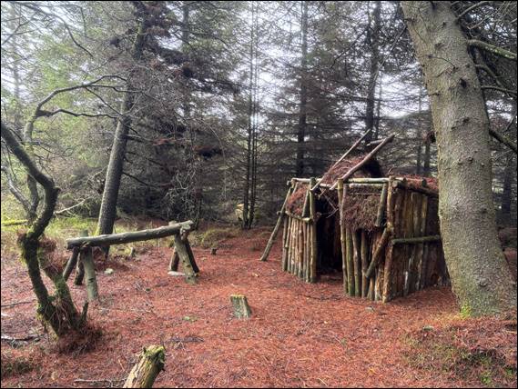
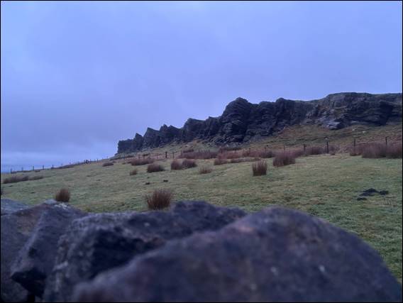
With no paths and deep in the woods we came across the above shack, which someone had painstakingly built. Continuing up to the top of Hoo Moor to allow us to see where to go, and from here we sighted Windgather Rocks. This terrain had no paths and was a bog land of tuffs and holes, ready to fill your boots with water. This happened regularly. It was slow going, and made even slower when we tried to cut through a felled pine plantation with dangerously slimy and rotten timbers. It was no longer a Sunday stroll, and Dave pulled me up and talked sense into me. We retreated and circumvented the dangerous path:
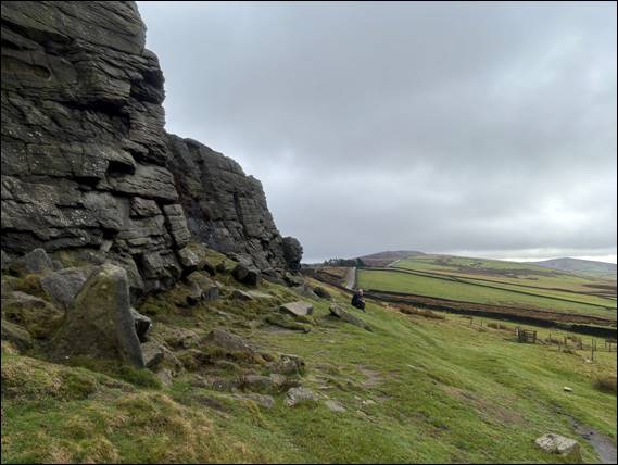
Back on the bog lands we eventually found a path that took us to Windgather Rocks. Weary but very happy. Here I had to at least have a close up look at what the place had to offer, and being sensible I did this from the ground. Dave meanwhile sat there looking across the valley caught up in his own thoughts. Then as we were about to leave he pointed to a slab and said it looked pretty good, and that was enough. Despite the wet and muddy boots I headed up the slab. Dave tried not to watch but couldn’t stop himself, holding his breathe the whole time. Maybe next time I’ll get him up a line or two here: