Who is Dave the postman you may ask. He has been the deliverer of post for my Mam and Dad since they moved up to Romiley some five’ish years back. And my sister, Seeta, for as long as she has been living in Romiley. He had been delivering the post on that particular round for thirty years up until a few weeks back. And being a well-liked and friendly character, he has built up a great relationship with many on his rounds. And I know my folks for one, will dearly miss his friendly chats as he check in to see how they are going:
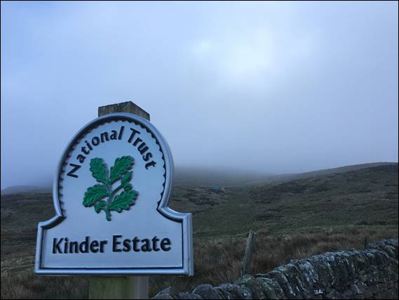
He is still delivering post, so why the move you may ask. It’s simply really, he is now delivering from the sorting office just round the corner from where he lives. And in an equally quiet and pleasant part of the world, one from which on a clear day Kinder Scout is clearly visible. You may also ask how it came to be that I would be taking a day out from my trip to see my folks to head into the hills with Dave. Well he took a liking to the weekly postcards I would send to my folks, personalised with an image from our life and my adventures:
With my folks, and my, knowledge and acceptance he always enjoyed seeing what was happening in our life down under. And knowing I enjoyed the great outdoors and also indulged in early morning wanders when back in Britain, he had offered to take me out for a day hiking sometime, if I was keen. We had attempted to make this happen last September, but the weather and illnesses got in the way. And being truthful, as Lisa, Elseya, and Griffin had also joined me for that week, it also felt kinda wrong to head away for a day:
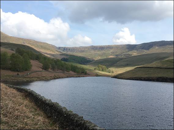
This trip however, I went by myself, there were no bugs to hold anyone back, and the weather forecast was looking favourable. So Wednesday morning I was being picked up at six thirty from my folks house, where Dave first had to apologise to my Mam for moving to a different delivery round. Something that had happened pretty quickly, so he did not have the time to say farewell to all the locals. Then it was a quick thirty minute drive to downstream of Kinder Reservoir, where we shouldered our packs and continued on foot:
Dave has been up Kinder Scout numerous times over his life, being a local lad. And during his first week of delivering on his newly acquired rounds he had looked across to it, and thought it may be a good destination for today. He had asked if I had any preferences, and while I pondered suggesting a few places I knew with great rocky edges full of fun routes I resisted and allowed him to choose. I didn’t find out our destination until the day we drove put, and was not disappointed. Having been up Kinder Scout only once before, thirty years back:
It is the highest point in the Peak District, at a lofty 2,087 feet above sea level offering lovely vistas. It was also the site of the 1932 Mass Trespass, a time when rambles from nearby towns peacefully protested to ensure public access on what was then private land. This event assisted in resulted in changes in legislation and was an instrumental part in the campaign for open access. This eventually led National Parks being created in Britain, with the Peak District being the first one founded on 17 April 1951:
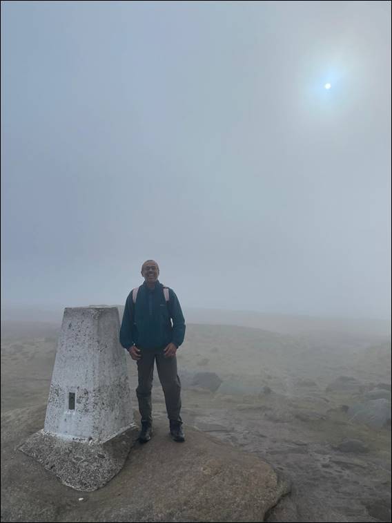
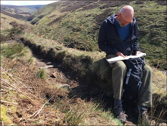
It’s a place steeped in much history and culture, and Dave was a fountain of knowledge as we walked and talked. He was however concerned that the day may not turn out as good as forecast, as we walked up the incline to the trig point at Kinder Low (2,077 feet). There are some six and half thousand trig points, which were built from 1936 onwards to assist the Ordnance Survey in creating a single national map and one reference system for Great Britain. This resulted in the OSGB36 datum and the National Grid, a system that is still used today:
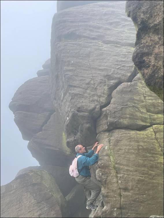
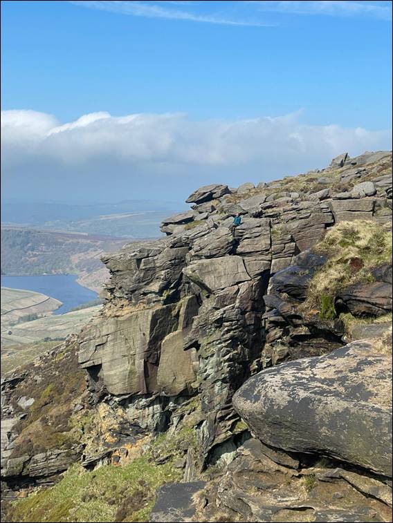
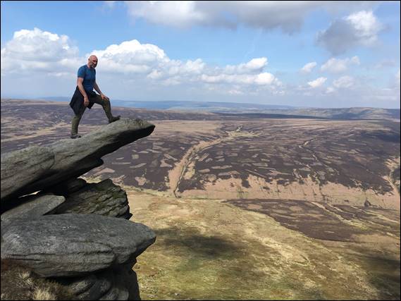
You may notice the trig point is not as high as the highest point on Kinder Scout, by ten feet or approx. three meters. The highest point does not have a trig point, and is merely marked by a mound of grass and small cairn. But once on the edge of the plateau the views are equally stunning from all directions and heights, so while we didn’t reach that extra ten feet of elevation it made no difference to the experience. You will also have seen that I got to play on a bit of rock, holding myself back from going too high as Dave watched on nervously:
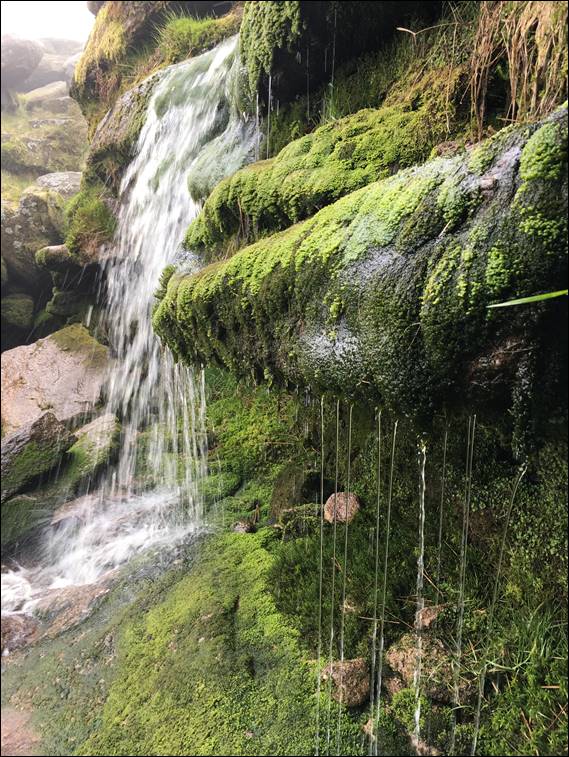
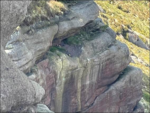
The clouds came and went, and two images up we reached the waterfall of Kinder Scout as the cloud rolled back in. The only other time I have been here, there was more water flowing over it and the wind funnelled up the valley. Blowing the falling water right back up and over the waterfall. Creating a stunning rainbow in the mist filled valley. Today it was a mere trickle, and as Dave explained while it has been damp and cold it had not been raining heavily for prolonged periods. The low flows coming off the peaty plateau back his views:
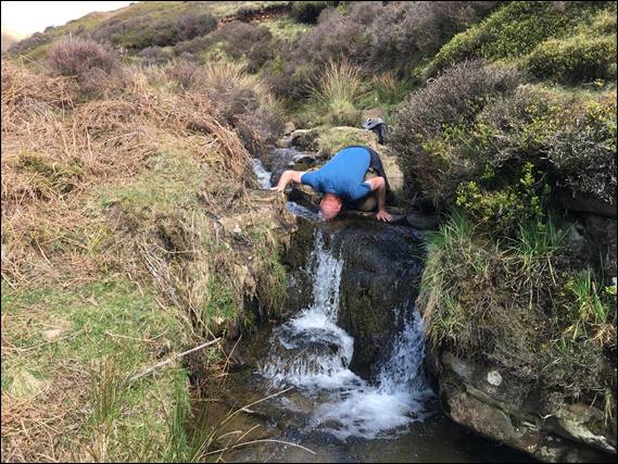
As we watched the trickle of water, I spotted some climbing gear part way up the waterfall and mentioned it to Dave. Suggesting that we could try to get down there to check it out, but also saying it may be too hard to get to. He was keen to find a way down so we scoured the immediate valley, guarded steep rocky outcrops. Spying a likely decent we walked round crossing the creek. This is where I took the close up image and the amount of water looks bigger than it is. I was however taken by the all the lush greenery:
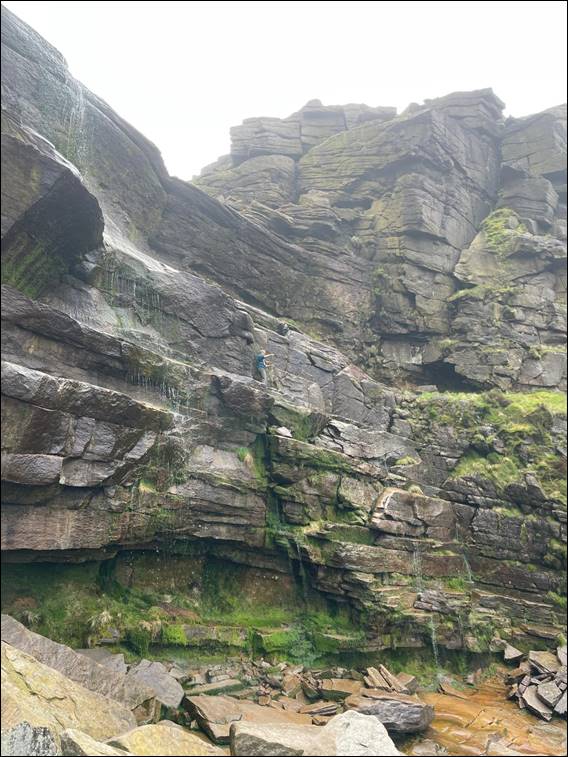
To get down we had to down climb a chimney and pop out of a small opening onto a final rock step. Dave confessed to having never progressed from hiking to true scrambling, so this took him out of his comfort zone. But showing determination he managed to get down. A low level traverse then took us back to the head of the horseshoe shaped valley and the base of the waterfall. Dave was content to watch from the side while I scrambled across to the right-hand corner and climb up the falling water, before traversing left to retrieve the gear:
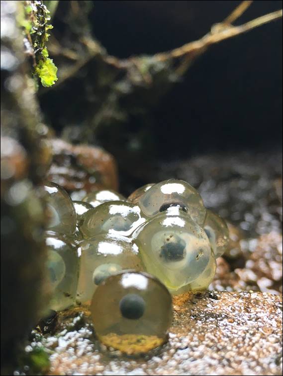
He confessed that this made him ponder his options if things should go south, so was relieved when I got back down. He had even scrambled across to the base of where I had gone up, and I reckon with a bit of encouragement I could easily get him into scrambling and maybe even climbing. Back at the packs I spotted the above spawn in a crevice where the water was splashing up. We weren’t sure if it was frog or toad spawn, but it may be frog spawn which is laid in clumps as opposed to toad spawn that is laid in strings:
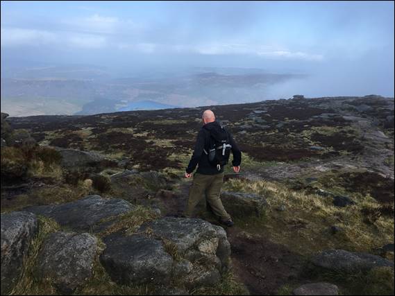
Scrambling back up to the main plateau, we had a sit down and bite to eat looking out and the clouds lifted for good. I had to resist the temptation of scrambling back down to climb up one of the many inviting features, as we relaxed here for a bit. Eventually we continued on our chosen path being the thirteen mile Kinder Scout mass trespass walk, which we were doing in the reverse direction to the linked site. Our time on the plateau was coming to an end and soon we made our way down the steep steps to a crossroad in the path:
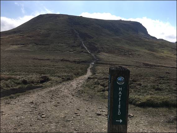
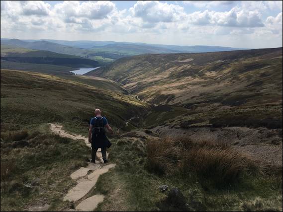
The steep decline can be seen below, and it was during this descent that we saw the most people on what was otherwise a quiet day. We had cheerily said hello to them as they huffed and puffed their way up, something we were to ponder on later. It was still early as we hit the crossroad and our direction was towards Hayfield, but I was tempted by the sign pointing in the opposite direction to Snake Inn. Dave reckoned it would be a couple of miles and maybe an hours walk to get there, but he warned it may no longer be a pub:
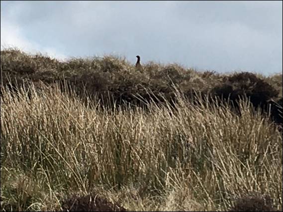
Many of these pubs have their original name and have sadly been turned into bed and breakfast places, but we walked on regardless. Listening out for the familiar calls of the more common moorland birds such as the Skylark (Alauda arvensis), which true to its name came out to play in numbers when the blue skies came. The distinctive bubbling call of the Curlew (Numenius arquata), which we heard but only saw on occasion. And then there were the Red Grouse (Lagopus lagopus) shown below, given away by the fleck of red on its head:
None of the birds we spotted allowed us to get too close, as we walked and walked. The valley meandered round the ridges that dropped into the valley, and each time there was no sign of the A57 or the more commonly call Snake Pass. A road that connects Manchester and Sheffield built way back in 1821. With each footfall there were two thoughts in my head. What if the Snake Inn isn’t a pub anymore and secondly we are going to have to walk back the same way, which somehow was becoming less and less inviting:
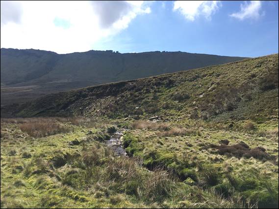
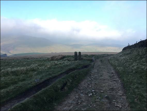
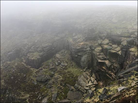
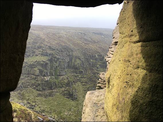
Eventually we had a conflab and decided it was time to consult the map. The result was that the two miles and approx. one hour was a tad of an underestimation. We could well have been two thirds of the way there, but it may be less. The road passed through the dark green forest all the way at the end of the valley to the right in the image below. Neither of us were keen on going all that way just to turn round and come back without the reward of a pint. So it was time to make a decision:
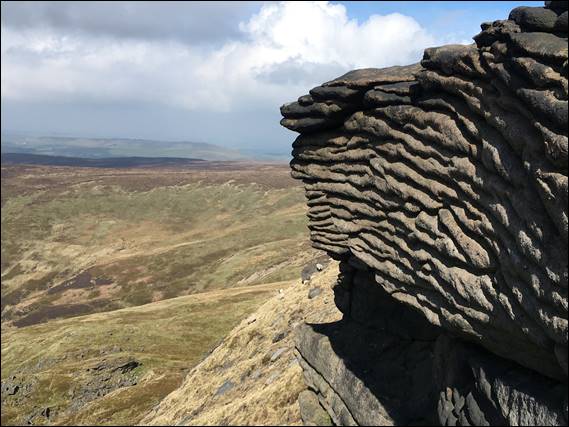
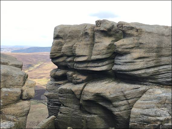
So for a second time we went off track, deciding to take a rising traverse up the side of the valley to reach The Edge. The rocky skyline shown two images up. We spied a section that wasn’t guarded by near vertical rocky outcrops and started our way upslope. With no path we had to be careful on the tussocks of grass, so as not to twist an ankle. Dave saw a movement in one of these and we dropped to our knees looking about to find the first reptile, being a Common lizard (Zootoca vivipara):
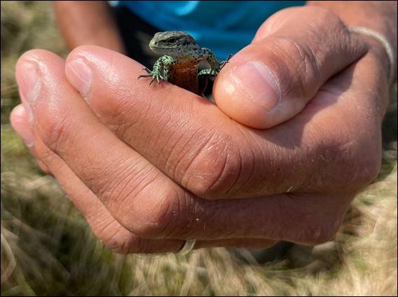
As the name suggests it is the most widespread and common of the lizards found in the United Kingdom. This one however is just a little less common in that it is a green variant. I say just a little as while they are usually brownish-grey, colour variants are not that unusually and can include yellows, green, and even jet black. As we sat in awe of our find Dave also spotted a small section of a moulted snakeskin. There are three species of snake in England although the habitat of Smooth Snake (Coronella austriaca) is restricted to the south:
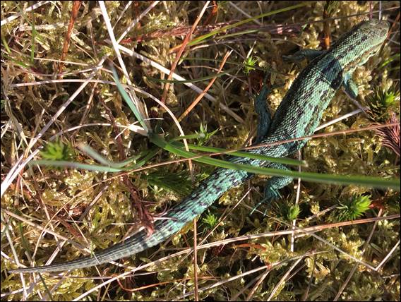
As such it was either from an Adder (Vipera berus), the only venomous species, or more likely a Grass Snake (Natrix helvetica). I’ve only ever seen one snake in England and that was an Adder trapped in a well, which I managed to rescue. We didn’t see any more reptiles, and as we continued the trudge up the ever steepening slope we reflected on how chirpy we had been towards the people hiking up the steep steps. Not that we would have begrudged someone being friendly and saying hello, but a little less upbeat may have been better:
We made it and were now ready for some lunch. Our legs had that tree-trunk feeling, which was probably fair seeing we had hiked up to the plateau twice now. As we had made our way up the last sections we had spotted a Peregrine Falcon (Falco peregrinus), or more truthfully it had spotted us. Circling in and out with a rasping kack-kack-kack-kack sound. This was a warning as they are generally silent. And sure enough we watched as it landed on a horizontal break on a short buttress not far away, and from above we spied three eggs shown above:
It looked like one egg had rolled out of the nest, precariously sat on the edge it was probably done for. We ate some food at what seemed a safe distance and out of sight of the nest. Not far enough obviously, as the kack-kack-kack-kack sound continued so we moved on to leave it in peace. As we followed The Edge towards the top of the steep steps we had previously walked down, we marvelled at the many rock features. Along the way I noticed the patchwork pattern in the moorlands on the opposite side of the valley:
Dave explained that this was done to boost the Grouse populations for when the grouse-shooting season begins on 12 August. He also told me that over the years he has tried to find a number of aircraft crash sites, and pointed one out to me in the valley side way below The Edge. I’ve read there may be in excess of three hundred across the Peak District. Many occurred between 1939 and 1963, and nearly all were military aircraft. The majority of crashes are reported to be due to navigational errors, during poor weather conditions:
Most of the pilots in world war two did not have enough training, were very young, and unfamiliar with the landscape. To work out their location when they were lost they needed to drop below the cloud line so they could see landmarks such as roads. This combined with the topography often led to them crashing into the hillsides. At the steep steps we went down, this time not meeting anyone coming up. And at the crossroads, we followed the sign to Hayfield. Taking us down William Clough and towards Kinder Reservoir:
Similar to as we attempted to reach the Snake Inn, a creekline gurgled away the entire way down the path until it dropped into the reservoir. It was a wonderful sound. Dave cooled his head off part way down, and we then stopped just shy of the reservoir to soak our feet in the cool waters. The track then became a much more well-trodden path along the reservoir, for the final leg back towards the car. This time Dave purposely said that this last leg always felt longer than expected, maybe due to the underestimation of his previous thinking:
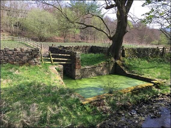
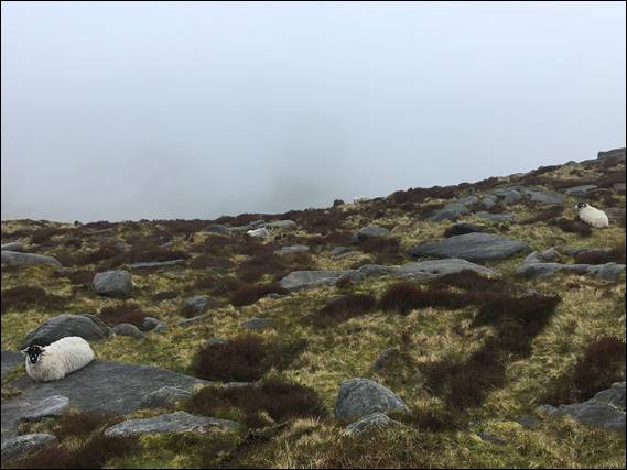
Not that the deviation from our planned hike had worried me. It had certainly provided us with some great sights both big and small. And as we got closer to the car I was impressed with one more sight. What might be considered an over-engineered sheep dip built between 1900 and 1910, still standing strong but no longer used. We had seen sheep all over Kinder Scout, and wondered how they were rounded up seeing they were spread across such a vast and at times difficult to access landscape. The answer is simple, hard yakka: