The Monadnocks Conservation Park, covering approx. 20,000ha, stretches a considerable length along the Albany Highway that runs to the south east of Perth. A place I have been to before, but just not realising what the name of the area was. The term monadnock is defined as an “isolated hill of bedrock standing conspicuously above the general level of the surrounding area”, and I wondered how this differs from a term I am more used to hearing being monolith. The large granite domes of places in England, such as Bodmin Moor and Dartmoor, being referred to as monoliths:
The word monolith has quite a few meanings, one of which is “a geological feature consisting of a single massive stone or rock”. So regardless of which term you prefer, the result is the same. A park with very hard and solid igneous or metamorphic rock formations that have been exposed by erosion, and which stand proud above the lower lying landscape. With this park getting its name from three distinct granite peaks, being Mount Vincent, Mount Cooke and Mount Cuthbert:
The latter of the three peaks is where I went last time with Mario, who was again my climbing buddy for this trip. A relatively short hours’ drive for him, and two and half hours for me meaning I had a “well before crack of dawn” start. Our destination was not to the peak of one of the three monadnocks, but a relatively small slabby section that was named Over the Hill by the people that developed the climbing here. The name should have given me a hint of what to expect on the approach, and to some degree it did as I came armed with approach shoes instead of sandals:
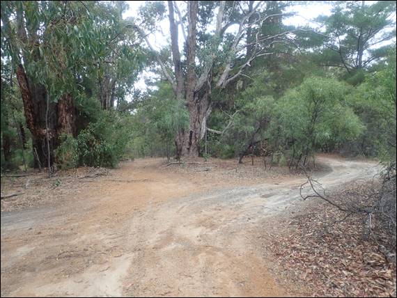
Arriving with five minutes of each other and parking off the Albany Highway, we walked west. A mere 1.4km, as the crow flies, but needing to cross over a smaller monadnocks. One that had no name attributed to it, and stood at approx. 480m above sea level. It was about 100m lower than the highest peak of the park, Mount Cook. The highest peak was not visible on our approach, despite only being 4km to the north, as it was cloaked in cloud. Our hike took us 140m’ish uphill and then 90m’ish down the other side. Typing this it does not seem too bad, but it felt like hard work:
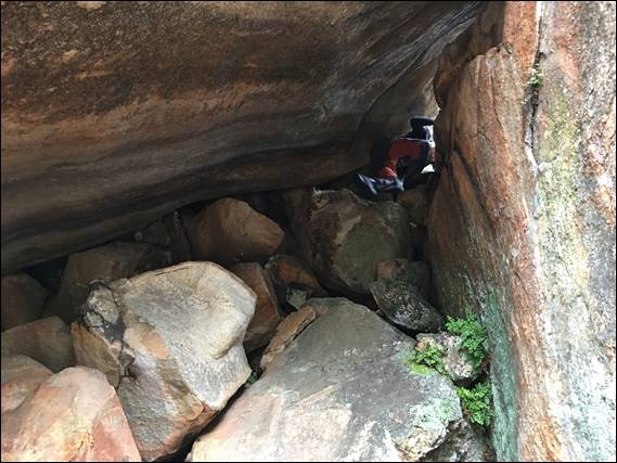
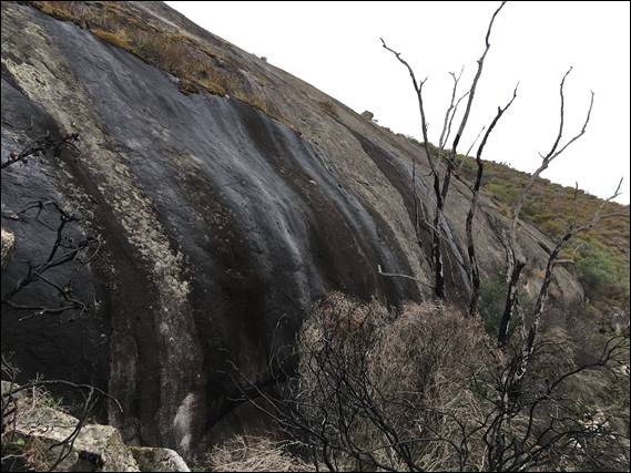
Mario, somewhat fitter then I am, took it in his stride and eventually after a bit of mucking about we managed to find the climbing area. Comprising two sections, split by a large boulder that you can scramble under to get to the two spots. On arrival we approached from the north so looked at the left hand section first. This looked in reasonable condition, as show two images above. But the right hand area was seeping sufficiently to render much of the steep slabby walls unclimbable. The area had received a couple of inches of rain a few days back, enough to soak the vegetation and soil above and keep the seepages flowing:
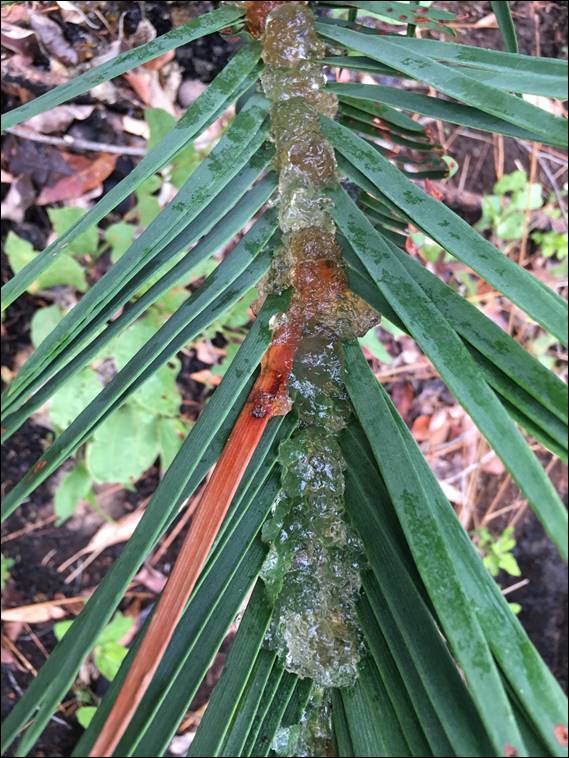
Before I go too much further I need to quickly go back to the second image of one leaf from a Zamia Palm (Macrozamia riedlei). We came across these on the hike in, but only a few in one spot were liberally coated in the clear looking gelatinous sap shown in the image. Something I had not seen before, and my initial thought was that sap dropped from the Jarrah trees could have dropped down, but their sap is usually a deep red colour. So with Howsie’s assistance, all that we have been able to identify is that this sap can be exuded as a defence against insect attack:
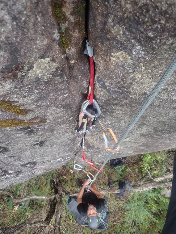
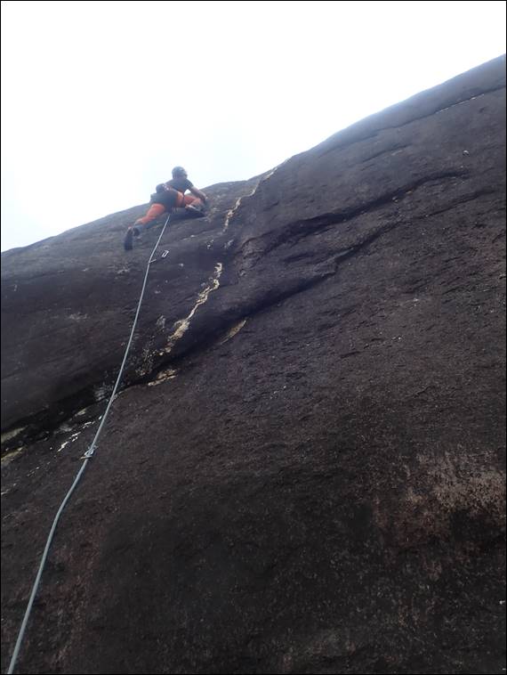
When Mario had initially got in touch to see if I was keen for another adventure on a Perth crag, he had three locations in mind. I had only been too one of them before, and of the other two the first was a collection of largish boulders that would yield relatively short routes, and then there was this place that on the face of it based on the descriptions would offer 15m plus routes. As such the choice, for me, was easy. The conditions dictated that we should started our climbing for the day on the left hand end. Here the rock was mostly dry, although in the above crack there was a bit of moisture and this made the finger locks somewhat insecure. The routes were fun, with two glory lines that stood out:
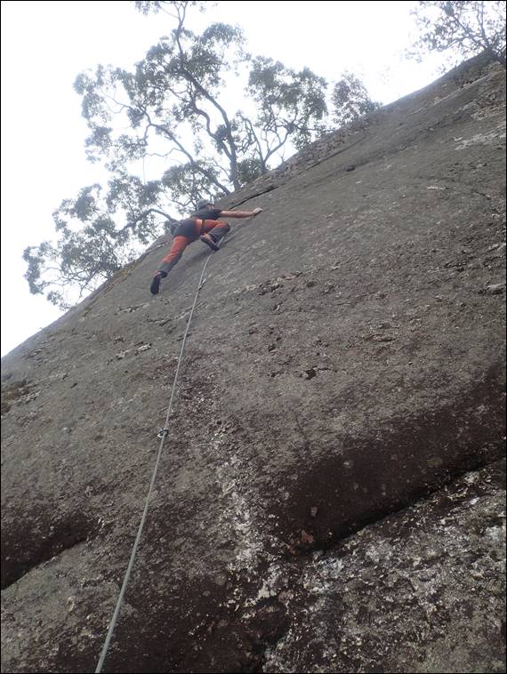
Both slabs, providing sustained grade 21 and 22 routes. The first shown above was amazing, but felt a little tough when compared to similarly graded slabs at Mount Frankland. The second however had me completely baffled, Mario looked smooth and controlled for the first third. Then he slipped and found it tricky to get focused enough to continue the ascent in the same style coming across one section near the top that had him completely perplexed. When I attempted that line I pulled on draws several times and had to finish it off by aiding up with the help of a sling to stand in. It has to be one of, if not, the most ungraceful ascent I can recall:
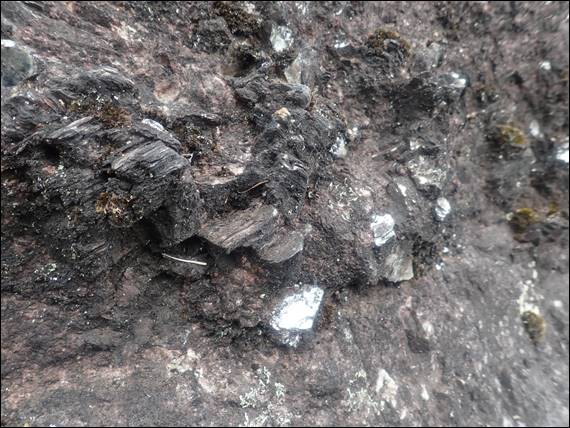
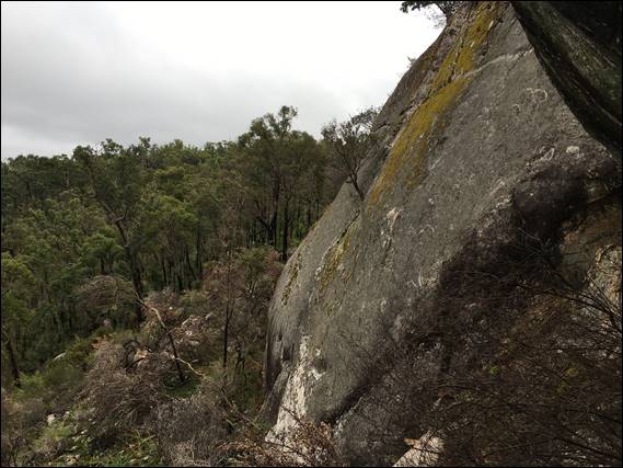
We both considered it was very hard at the grade. Other factors may also have been at play, but even at grade 22 to have a section that had us both completely at a loss was very strange. That said at times it is good to be handed a good spanking, and it certainly felt like I had. With five routes under our belt, if I can count that last one, we moved across to the right hand area. Truth be told the whole area felt a little scrappy, and image wise it was hard to get many climbing shots worthy of including. On the plus side the rock had some great unusual features, shown above and which I had not seen before. Called pegmatite, these formations comprise of quartz, feldspar, and mica just like granite:
Unlike granite, and what makes them standout is the size of interlocking crystals, which are individual usually greater than 1cm. These provided interesting viewing and also some very unique and at times strange holds. Despite the initial wet looking nature of the area we managed to find a few dry lines to play on, and the climbing was technical and interesting. In addition to the pegmatite holds there were fun underclings with the above one, which we thankfully didn’t have to make sue of, providing a great habitat for what I assume are wasp nests:
It was a weird spot to have invested as much effort as had been. Generally the climbing was less than 10m followed by at times a 15m runout to the anchors on an easy slab to the lower offs. Plus a number of the routes were so close you could clip the bolts of multiple routes, as you climbed. But that said it was great to come to yet another location I hadn’t been to before. And after nine routes at an average grade of 19 I was feeling it, plus Mario’s stomach was starting to grumble, so we called it a day and started to ready ourselves for the hike out:
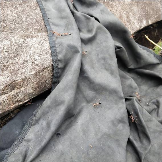
But we had one more battle on our hands. While I could not locate any nearby nests, the resident bull ants had taken offence to the rope bag. They were not interested in our shoes, rucksacks, or other climbing gear that was strewn across the base of the rocks. So we abandoned the rope bag until the final moment, and when we came back to it we found the usually solitary ants scrambling all over it in double figures. Watching them for a while they acted aggressively to one another when their paths crossed, but they were seemingly not too worried about us:
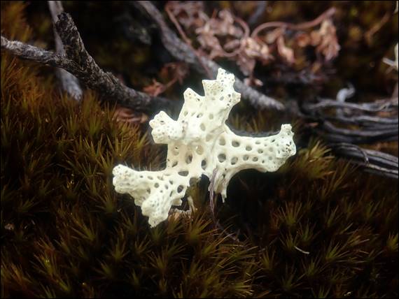
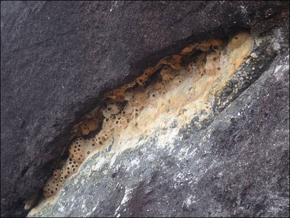
The walk seemed longer on the way out, especially the downhill section back to the Albany Highway. Weariness was probably a key factor for that. We took a different path to the way we had approached the crag, and came across what I believe were Lacy Coral Lichen (Cladia ferdinandii). Shown above, we only saw a few of them being relatively small and incredibly delicate looking. The colour was more yellow than the image shows, having being bleached out by contrast on a cloudy day. While it was another successful and fun trip out, with some interesting finds I’m not sure the climbing was of a quality that would entice me to head back over the hill: