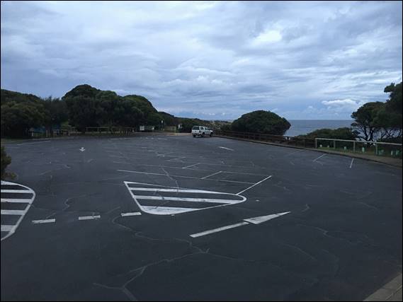
Next week I’ll pick Lisa up from the airport. So with just me to get out the door I got an early start on another loop walk detailed in our Walking in Circles book. I rolled into a sleepy Gracetown as first light crept across the sky, and parked up as instructed in our trusty book. The loop today was to be a 17km trek that they reckon would take +5 hours, but I had 4 hours in my mind. It started with a short stroll back through Gracetown until Cowaramup Brook is reached:
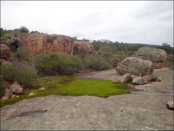
I knew where I was going, it is a place where I have climbed before. There is a lovely track on the northern side of the brook, which leads to a granite outcrop. It has been many, many years since I have climbed here, in part as it doesn’t have a lot on offer and can feel a little scrappy in places. Looking at the lines today I felt I may have been a bit harsh and this place probably deserved another visit. It will however have to wait until we get through winter, and the places dries up:

I’ve not followed the brook beyond the outcrop, so from here on in I had to trust in the book. The brook was properly flowing and the cascading water sounded wonderful, accompanied with a variety of bird song coming from somewhere within the vegetation. The track stuck reasonably close and I couldn’t help myself and ducked down to the water’s edge to take a few images of a waterway that is in great condition. I say this as on Friday afternoon I was on a panel to discuss our waterways, which happened after the audience had watched a recently released film called River (https://www.abc.net.au/news/2022-03-24/river-documentary-willem-dafoe-jennifer-peedom/100932194):
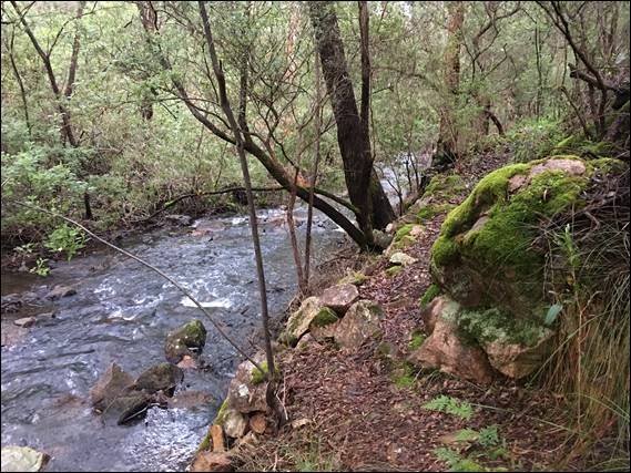
The film had incredibly little relevance to our waterways, but during the Q&A session there was a lot of discussion about the poor and degraded state of our waterways. This is true for many waterways but not this reach of Cowaramup Brook, which I would say is near to pristine with only a few weeds here and there. I was having a little trouble identifying where I had to cross the brook, a path up the steep bank on the other side should have been clear. But I found none, so I just kept following the brook way further than I should have. To the point that the path disappeared and I had to start bush bashing:

I could hear Lisa’s voice in my head, maybe we should turn back. But I kept an eye on the opposite bank and where it seemed to clear, and then decided to cross the brook at the above location. Stepping gingerly on the rocks protruding from the water and covered in slime. And here Lisa would have insisted we turn back, but being alone I forged forward. The scramble up the opposite bank to reach the ridge looked harmless enough, but the higher I got the thicker the vegetation got and eventually it was anyone’s guess as to which way to go:
I popped over the ridge and spied an open area that I hoped would give me the chance to scan the landscape and land forms. But all that could be seen was vegetation, other than a couple of rooftops only just visible. No doubt someone’s secluded retreat. Pulling the book out I scanned the map, which has contours on it. The landform I was seeing was way more pronounced and varied that I expected, resulting in the ridges and valleys I was seeing not making a lot of sense:
By now Lisa would definitely not be happy, but she will be happy to hear I pulled out my phone and thankfully had reception. Normally I have a pretty good sense of direction and can work out roughly which way we need to go. However, somehow in making my way through the vegetation up onto the ridge I must have done a 360. The way I had intended to go would have taken me back down to the brook. So trusting in my phone and after a short couple of hundred meters I found the track:
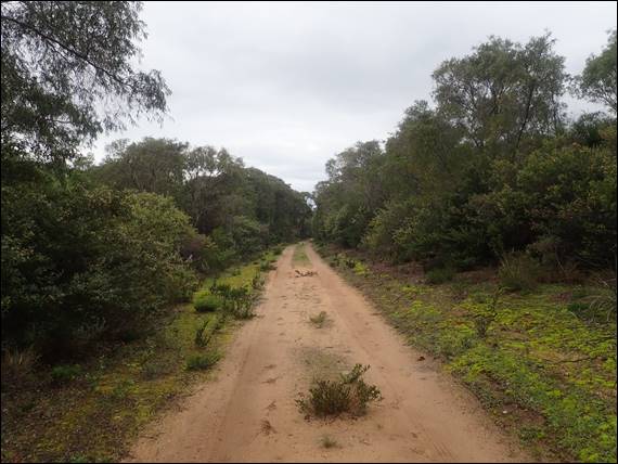
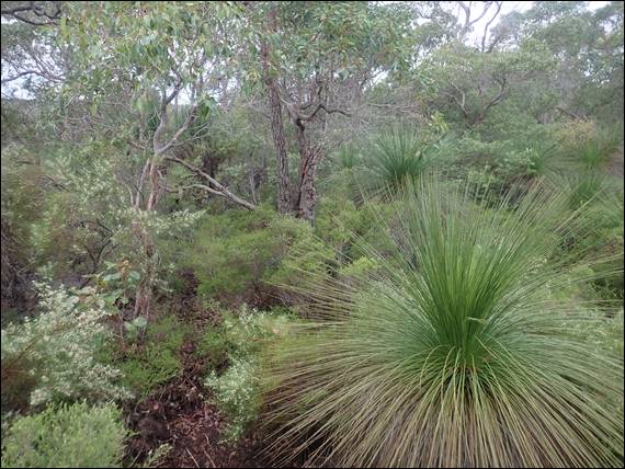
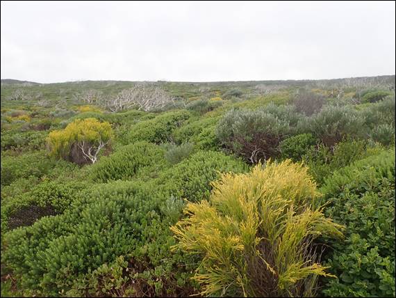
The first couple of kilometres had chewed up close to an hour and half, which looking back didn’t surprise me. But being back on such an easy wide track to follow I was still confident I could make the time up. The track had quite a few junctions and I pulled out the book at each one to make sure I didn’t come a cropper a second time. I also reverted to using my phone a second time when the book simply said turn left (south) and follow a sandy track through peppermint, wattle and basket bush. This was that sandy track:
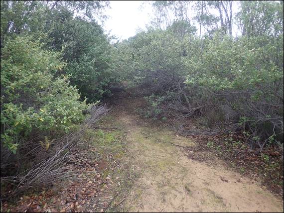
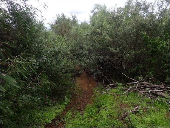
The above image, might look innocent but don’t be fooled. While the path at ground level could be seen, the surrounding bush has over the years taken hold. It was a real battle to force my way through, and at times needed to get low down to look for the way forward under the thick scrub. To avoid being completely smashed I also resorted to crawling on hands and knees through some sections. Again Lisa’s voice echoed, go back. When taking the above image, which was a mere 200 meters into this 1.5 kilometre stretch, it dawned on me I had lost my glasses:
I battled the same 200 meters of thick scrub a not once but twice, as I went there and back two times scouring the ground as best I could. But no luck my glasses were nowhere to be found, so I carried on. Several times the track was completely lost from sight, but I had entered my stubborn “I will not be defeated” mindset. Each time I eventually found the track but by the time this 1.5 kilometre stretch, plus an additional 0.8 kilometres searching for my glasses, was behind me I came out completely batter, bruised, scratched and speared:
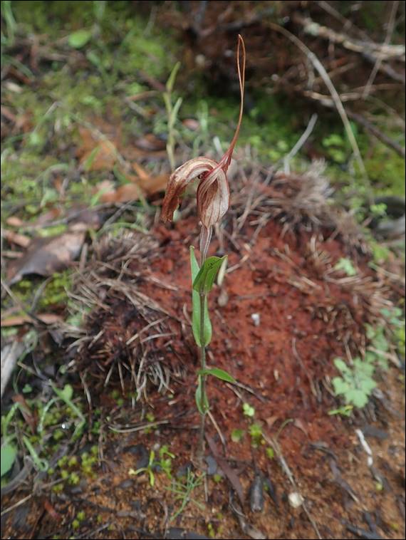
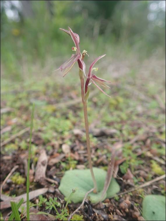
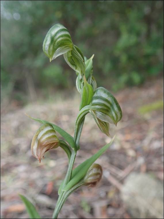
Fortunately the path went back to a wide track, easy to follow and impossible to miss as long as you took the right direction at each junction which the booked helped me to do. The battles behind me were rewarded when I spotted a Cape Mosquito Orchid (Cyrtostylis sp. ‘Cape Naturaliste’), and as the name suggested it is only found on this stretch of coastline. I am not sure how I spotted it without my glasses, although the next two finds were a bit more obvious. Above, sadly just starting to wilt, is a Curled-tongue Shell Orchid (Pterostylis rogersii) of which there was a group all in the same state:
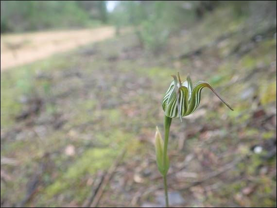
Not having previously sighted either of these orchids before, needless to say I was chuffed. Then as the track reached its peak and the ocean came into view for the first time I spotted a small group of Jug Orchid (Pterostylis recurve). Not only are the colours different, but the sepals point down, whereas for the shell orchid they go up. Lisa would have liked this section open views, easy path finding and a few good finds. Although she might hint we should keep moving. The book advised to keep a look out for a track on the left, which would be found soon after the main track started to descend:
I found it and stood there looking at it for a while. It was clearly a path, but with the scrub leaning well over the narrow path I was again reminded of what that previous section had been like. The book stated that this path should be followed for 1.5 kilometres, the same distance as that last horrendous, even by my standards, track had been. It was definitely the right way, and there was even some tape marking it so I imagine it does get used. That same voice suggested I find another way, but I resisted that temptation and was pleased to find it was not as thick or hard to negotiate as the last track:
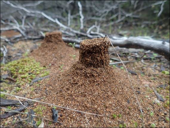
With the scrub easier to push through I kept an eye on the ground and spotted quite a few fungi. I did not stopped to take too many images of the fungi, I just didn’t want to squash them. In fact I didn’t see any squashed ones and also didn’t see any footprints, as I made my way down off the ridge. I also noted that all of the anthills, yes that is the name of these small structures, were intact. I did stop just once to watch one of them. The small ants went about their business unaware of the perilous location of the entrance to their underground home, being right on the marked path:
I feel like they were pretty safe, I honestly can’t see too many people ever making their way along that path. Indeed as I got to the valley floor the tape disappeared and I was left to find my own way the last few hundred meters to Ellensbrook Road. I was not so thrilled about walking on a road, but it wasn’t a huge distance and I knew that once I reached the coast I wouldn’t have to battle my way through any more scrub. Plus I spotted a couple of Banded Greenhoods (Pterostylis vittata), one of the more commonly found greenhoods but still great to see:
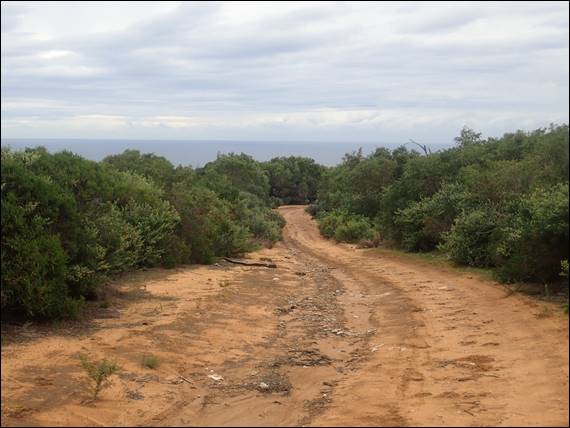
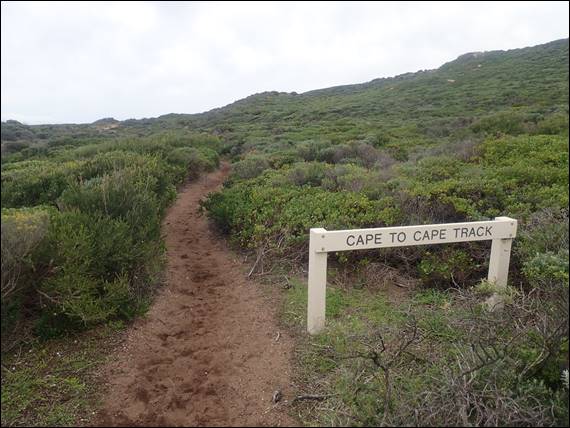
Finally I found myself on the Cape to Cape track, and from here it was just 5 kilometres back to the carpark. There was no way of getting lost now, just keep the ocean on my left. If I was with Lisa we would have stopped at the lookout, pulled the thermos out, and had a cuppa. Yes I had brought a thermos of tea with me today, and I am sure if Lisa had endured this walk up to this point the flask would have come out way before. But it had taken me four hours to get here, and I still had a little under a third of the walk left:
Not that I was watching the clock, but rain was forecast so I was keen to keep moving. Also if I was being completely truthful, the lookout had several people on it and I’m quite happy avoiding other people when out on these walks. I really had intended to have a cuppa when I got to the coast, but decided to go along the track for a bit to find a quiet spot. It took a while as I passed a couple of hikers, and of course once I started marching I didn’t seem to stop. At every bay I spotted surfers in the water, and I also came across them hiking along the track with boards under their arms:
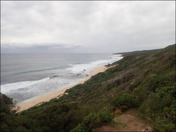
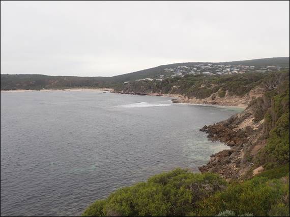
I was a little surprised to come across a couple of carparks, which were all packed. Surfers preparing to head out, packing up, or just watching from on high. This explained why I saw so many surfers on the track, some of them must have walked a couple fo kilometres to get to the break they wanted. The only diversion I made from my mission was to check out a bunch of boulders between the two carparks, they offered some short but worthwhile looking lines for something different. I logged that in my memory for future consideration and marched onwards, ignoring Lisa’s voice suggesting a cuppa was long overdue and that it would be nice to stop and look out for whales:
The track, outlook and vegetation didn’t change all that much and the presence of so many people detracted from this section a little for me. So I was pleased when I came over the final headland getting back to the car in 5 hours almost to the minute. I had really smashed the coastal stretch, and my legs were telling me so. All was forgiven as I pulled out the flask and poured a wonderful cuppa for the journey home, in fact I had three cups on the way home and every one of them went down a treat. Next time I pulled the walking in circles book out I hope there is a little voice in my head to say it is 12 years old, so a bit of caution is required: