Friday last week, as I did the finishing moves on the last lap on the final route of Rongy, Howsie and my before work climb at Welly Dam, Howsie said he had some exciting news. He and his best mate, Daz, were going to trek the Stirling Range Ridge walk. And whether it was the tone of my response or maybe Howsie was just putting it out there to test the water, either way I seemed to get invited to join them. On arrival at work less than an hour later, I checked my calendar and there was nothing I couldn’t shuffle about to make it work. Next I texted Lisa and she, as always, encouraged me to say yes:
I’m not sure if Daz knew anything about me joining before then, but Howsie checked in with him and he was fine with me tagging along. For which I was super grateful, and then it dawned on me that I needed to do some rapid thinking about what to take. We were to leave Thursday morning, giving me five days to sort my stuff out. And this hike is pretty serious and you need to carry everything including water. Being a ridge walk you don’t cross any creeks to fill up your water bottles, and while there is a barrel you might be able to fill up from you can’t depend on it having any water in it:
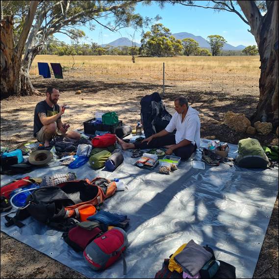
I’m pretty well kitted out for sleeping gear, but my rucksack is relative small at 45 litres and I would have struggled to fit everything in it. Luckily another person I told of my trip was Alan, who I knew had done the hike before and his first response was whether I needed to borrow any gear. All his belonging are in storage and as it happened, it was located at his mates work place and it was someone I actually knew. So Monday after work I was rummaging through his storage unit and pulled out his rucksack and a 10 litre water bladder:
He had suggested that I take his hiking poles, but I couldn’t find them and felt I would be alright without them. He said he wouldn’t hike without them, having been converted after one trip when he finally had a go at trying them. Lisa said I was dumb not to get some. Still I now had all I needed, although a friend at work who recently hiked the cape to cape track also offered me any gear I needed. So on Tuesday Clint brought in another 4 litre bladder and some electrolytes, I didn’t end up using his bladder as with 12 litres already I felt I had enough:
I did however take the army surplus electrolyte sachets, which were very welcome after a long day’s hiking. In addition to all of this organising I had numerous text chats with Howsie and Alan about multiple other things to check. This included essentials and who was bring them, such as a first aid kit, compass, etc. We didn’t want to be carrying extra items or doubling up, as with 12 litres of water in my pack was already 22kg and as it was all three of us had about equal weight on our backs:
Alan was a wealth of knowledge and I picked his brain about bits and pieces. I get the feeling he was as excited as me about the trip. He also sent me a copy of the ridge walk bible called Mountain Walks in the Stirling Ranges, which is a 1996 publication that is out of print and sold out. Someone really should print more copies, they would make a killing as this hike is getting very popular. He also provided me with a very handy map that was very useful and is worth looking at http://www.torridonbooks.com.au/ridgewalk_map.pdf. With all these offers of gear and a bit of knowledge I felt I was ready for this, other than fitness:
Seeing I was tagging along I went along with the plans that Daz and Howsie had made. This included staying at the Stirling Retreat Caravan Park, who were to provide our lift into the start and pick up at the end of the hike. One of the concerns I had was that the drop off time for the start of our hike was not till 8:30 or so, as a group had snuck in before us. They were starting from Bluff Knoll and heading east to Ellen Peak, whereas we were going westwards. So we couldn’t join their drop off and had to wait till later:
This was concerning to me as the temperatures were on the rise and Friday was forecast to be 27 and from then on it was supposed to rise by three degrees each day. In those conditions you really want to set off early in the morning when it is cool. I wasn’t sure whether to broach the topic with Howsie, not wanting to meddle with their plans. But he was happy for me to do so and he and Daz had already talked about hitting someone up from the campsite to give them an earlier lift. My first thought was to check in with Lisa and my friends, John and Margot:

Admittedly they ran the other campsite in the area but I know that us staying at the competition on this trip wouldn’t phase them. Sadly however, they were going to be away at that time, but wished us well saying it would be a glorious weekend for it. My next option was a very cheeky one. When Clint had found out what I was doing, he said his mate who he had hiked the cape to cape with was also going to be at the same campsite as us and intended to do some hiking in the Stirling too. As such he introduced us for a brief ten minutes on Tuesday morning:
When I met him Simon had come across as a very genuine guy, what you see is what you get and very approachable. So I sent him a text Wednesday evening asking if he could help us out. I thought I was out of luck as I didn’t get a quick reply, as Clint had said he was very techno savvy. Then in the morning there was a message not only saying he would be happy to help us out, but also apologising for the late reply. To boot, like me he is an early riser so an early lift was no problem at all:

I have to say that I am so grateful for the amazingly kind and generous people I know and continue to meet. So it was Thursday morning arrived, and after Elseya and Lisa had gone to work I waited eagerly to be picked up. Daz was driving down and offered to detour via Peppy Beach to pick me up, the last time I had met him was at Howsie’s wedding a long time back. Back then he had picked up and brought down a box of the South West Climbing Guides I had written, from the publisher in Perth, way back in 2015:

I was nervous about this trip for three reasons. First was that Howsie and Daz are like soul mates and have known each other forever, and it was hard to say how if at all my presence would change the dynamics. Fair to say it didn’t one bit and things went like clockwork and ran amazingly smoothly, and we all had the same attitude and thoughts in all decisions made. Second was the temperatures, and for those that know me this will come as no surprise. I will normally hide from the sun and for much of the ridge there is no hiding:
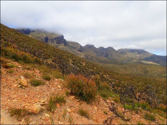
The forecast was admittedly based on the surrounding terrain, and these stunning peaks that tower from an otherwise flat landscape can and do make their own weather system. So much so that you can get caught out with unseen clouds or at times storms suddenly descending on you. I’ve experienced this before elsewhere in similar terrains and become very serious and sensible when it happens (https://sandbagged.blog/2017/08/27/part-6-scotland-the-long-road/). The forecast had however been stable and mostly clear skies were expected. Hence, while up high the air temperatures would be lower, it would be impossible to escape the full force of the sun on a cloudless sky:
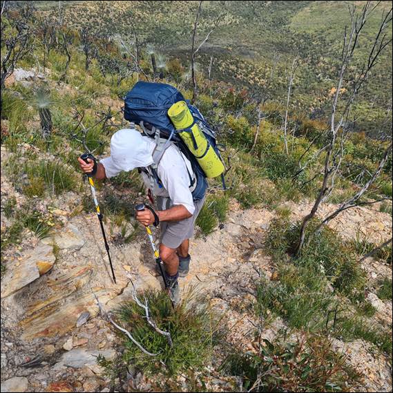
As per concern one, all went well and we had plenty of water to keep hydrated. My final concern, and probably the biggest, was my fitness and the weight of the pack. I’m used to carrying a climbing pack that can weight up to 15kg, but an extra 7kg is a big increase and added to that the terrain we were to encounter would often comprised long steep ascents. When Simon came by to give us a lift, at soon after 5am on Friday morning, he picked up my pack and groaned at the weight. But when I said I was nervous about my ability he made a very astute comment that anxiety can manifest from excitement, and when it does you just need to think about why it is exciting and focus on that:

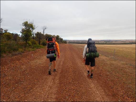
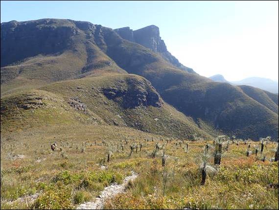
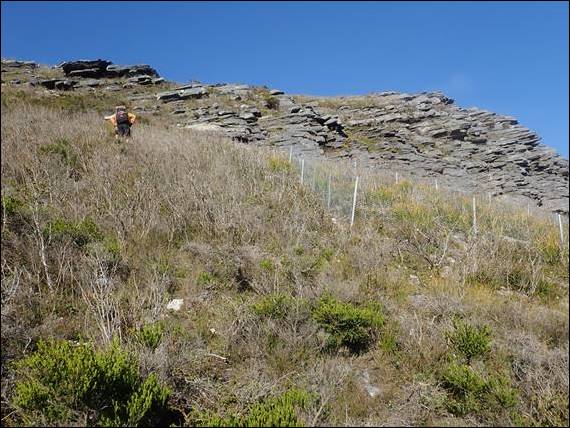
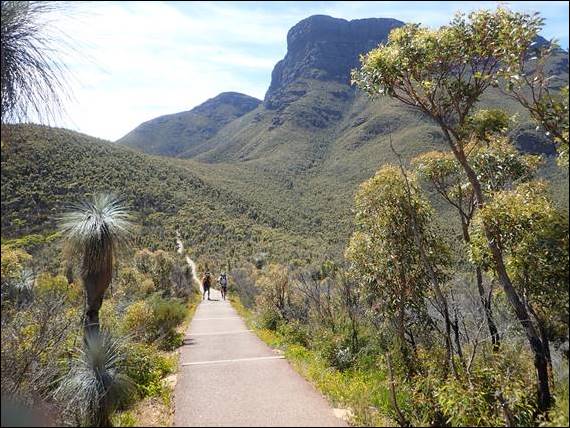
So it was that at 6am on Friday morning, Simon dropped us off at the eastern end of the mighty Stirling Range Ridge walk that would take us from Ellen’s Peak through to Bluff Knoll. He wished us well and as we started, and said he would be heading to Mount Trio to have his first sample of what the Stirling Ranges has to offer in the form of bushwalking. I need to check in with him as to how he went with the high steps up that peak. On our trek the first 5km was along a fire break, and it was the first time any of us had shouldered our packs and walked:
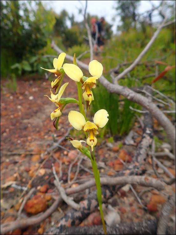
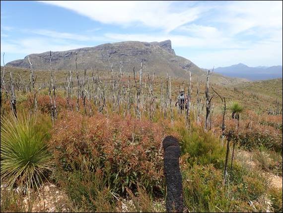
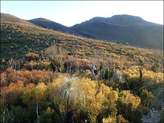
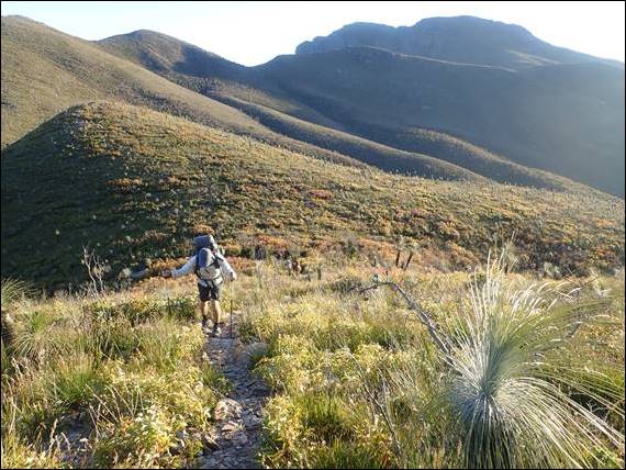
I might add here that on Thursday afternoon I spotted that the campsite sold hiking poles so I made a last minute decision and bought a pair, as did Howsie. Despite the poles the rucksack still felt heavy, very heavy, and my legs were feeling it from the start. Positive thinking was needed, but knowing they hurt on the flat made me more worried about the slopes. After the firebreak we found the trail that headed into the heart of the National Park and made a beeline for Ellen Peak. We couldn’t see any of the peaks as the cloud hung heavy across the ridge, and you’ll have to scroll back several images to see this. The path started flat and then gently inclined, which is where Howsie spotted an orchid:
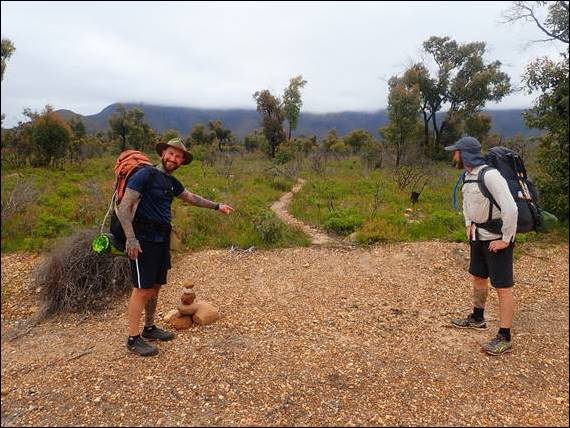
I hadn’t expected to see any, but here was one that I had not seen before. It was a Late Donkey or Diuris emarginata, and very different from the other Donkey orchids I have seen. Kneeling down with the pack on my back was not easy and when getting back up I decided I would now focus on walking and not photographing flowers. Fortunately we didn’t see any more orchids until the next day. Shortly after this find the track went steeply up to Ellen Peak, and as this happened the cloud lifted giving us out first glimpse of what lay ahead:
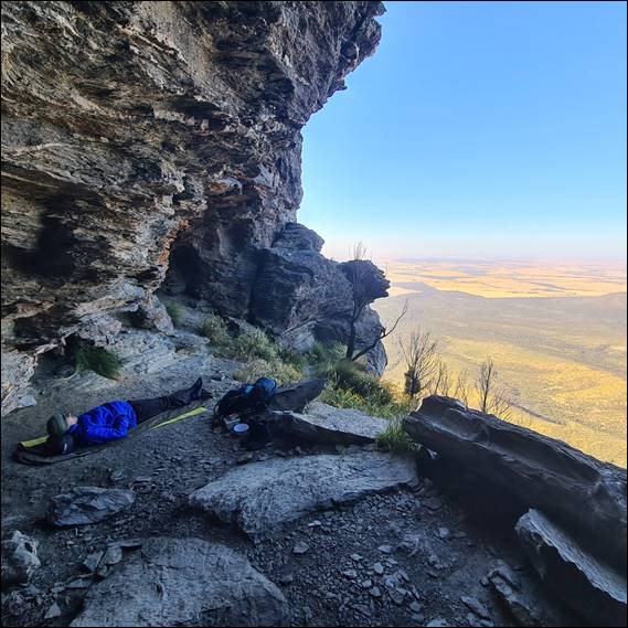
When we got to the base of Ellen Peak the tracked skirted round the base of the west side, where there was wonderful and very welcome shade in amongst the Sheoak trees. Here the bags were dumped, and the boys were keen to bag Ellen Peak. I however had to be sensible and left them to it, and lay there resting up in the shade. When they came back all buzzing it was time for lunch, while we still had shade. They later told me they had signed the summit book, the only one we found on the trip, and included my name saying I was sleeping at the base. I had no regrets about staying down and found it hilarious:

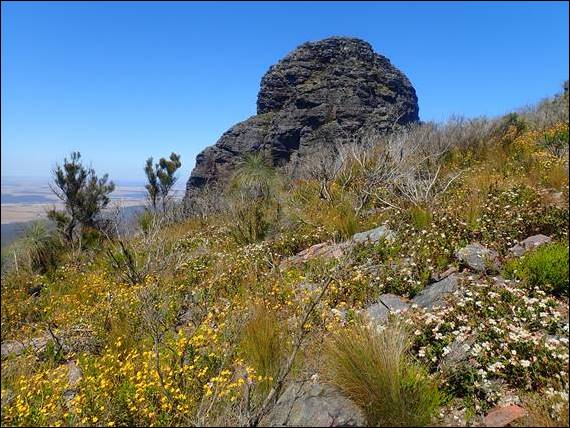
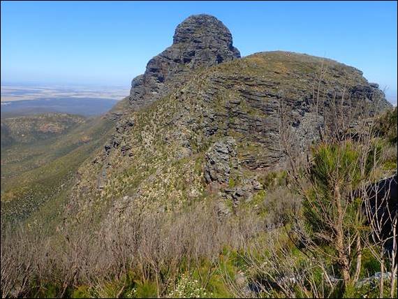
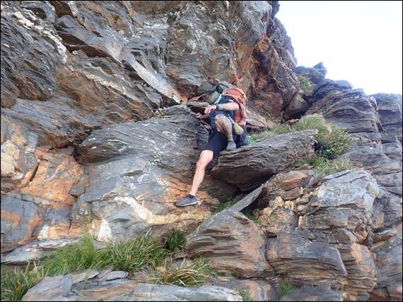
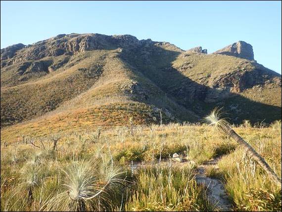
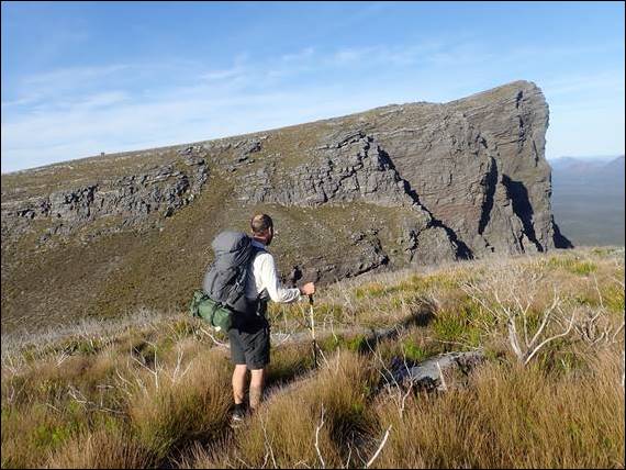
They also said a hiker had already been up there before us today. Shouldering the pack again after a rest was not much fun and the legs were soon groaning as we left Ellen Peak behind us. The next peak is Pyungoorup, which at 1,061m is second highest peak in the Stirling Ranges but is rarely ascended. Maybe it’s remoteness or maybe due to being a big rounded hill so not seeming so impressive? We didn’t go to the top, but followed the track that skirts the southern face blissfully in shade. Some way above there are two images, one showing Me scrambling down the “exposed corner” to access the south face, which was very fun:
The next images was of us walking through the sword grass, for which some people take gloves to avoid getting cut up. But it really wasn’t that bad, and the level ground was a relief, other than the hidden holds in which we on occasion lost our footing. If you go back to that image and look at the sheer cliffs, behind you might spot some ropes and a climber. Here we came across Jonas and a friend of his. I’ve been in touch with Jonas years back and he has invited to take me climbing in the Stirling Ranges, which is where he seems to spend most of his free time. But this was the first time that I have met him, so it was great to meet him and even better to meet him here:

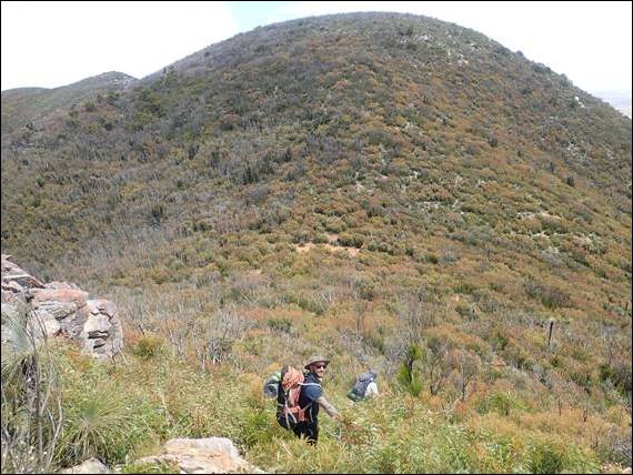
They were camping out for a week, and have been developing climbing routes up the very impressive south face of Pyungoorup. It’s a very big effort to even get there, let alone thinking of scaling those high steep cliffs. Maybe one day I’ll venture there when I’m more hiking fit, for today however there was not even a thought in my mind about climbing. After That peak we popped back onto the main ridge and into the sun. Heading for the Bakers Knob, a large rounded dome that resembles a bread knob. The hike up was a steady pace but going down the western side was a steep scramble, and there is an image above of the boys heading down:

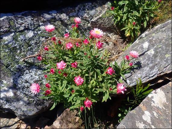
The image after that is of one of the many flowers that were out, there may have been very limited orchids but there were plenty of other blooms about. The image after that is looking back at the Bakers Knob and the seemingly impossible path that we had descended is lost in the sheer size of the feature. Strangely however, when we got to this section where there was a lot more scrambling involved the weight of the pack didn’t worry me as much and I really enjoyed this section. And even more the next, being Mirlpunda (The Three Arrows), which offered heaps of scrambling:

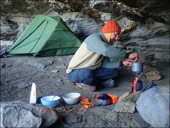
Three amazing peaks (arrows) with clefts between them making for very fun hiking, scrambling and even climbing. But today we were only going as far as the third arrow, which was the most easterly one. On the northern side is the biggest and best camping cave on the ridge. The person who had signed the book on Ellen Peak was here, so we shared this brilliant camp cave with Michael. There was plenty of room for all, but I am glad that the seven people who were also starting from Ellen Peak on the same day as us didn’t also turn up. We didn’t know they were behind us and never saw them, only finding out after we had completed the hike:
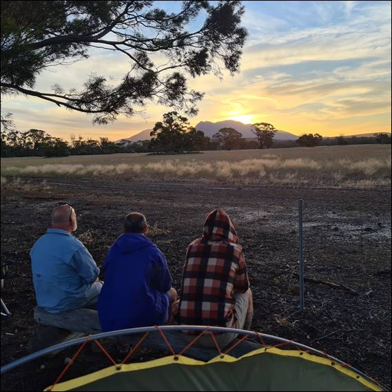
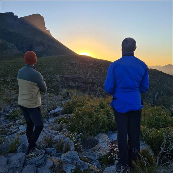
We had a great vista from the cave, which was 12km into the 24.5km walk. It had been a very big and spectacular day, but we were glad to rest up now and didn’t leave the cave till morning. From here we watched clouds start to form initially over Pyungoorup to the east, blowing in from the south. And then slowly engulf the entire view, before the wind started to howl above as we were sheltered in our cave. Dinner came at 5pm and I was in bed at 6pm, soon after the boys were getting cold and they too hit the sack. Next morning I could just make out the morning light through my bivvy bag and looked out to see the clouds this time below us:
I gently knocked on the tent that Howsie and Daz were sharing, suggesting they may want to get up to see the sight, even thought it was 4am. Daz had been hoping to be above the clouds and was stoked when he saw what greeted him, and many images were taken. In fact I’ve now come across someone who takes more images than I do. With such a spectacle unfolding before our eyes, we took our time to have breakfast and pack up. Michael left before us and was going home today, so would be heading off the ridge just after The Three Arrows. I was packed up and ready before the boys and knowing I would be slower going I got a head start:
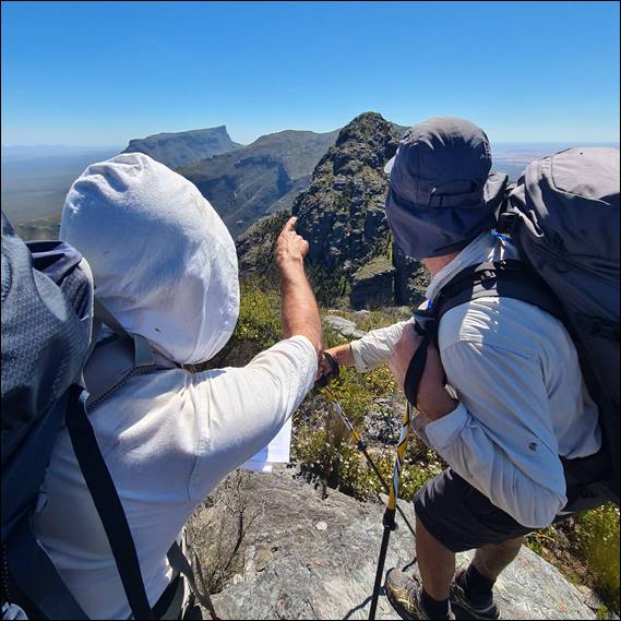
The pack was some 3kg lighter, as a result of what I had drunk and eaten, and it felt better. My legs were feeling tired but up for the challenge. We left the third arrow via central gully, and as I went through it our destination of Bluff Knoll could be seen way off in the distance. I purposely kept going and started up the back of the second arrow so I could get a silhouette image of the boys as they came through the gully, and once they caught up with me the three of us made our way up and over the second arrow:

The second arrow was the easiest to traverse, and from our reading we knew that the first arrow was the one that may provide more challenging route finding and also required steeper scrambling. Some people are even known to lower packs so they don’t need to scramble down with them on. But we all managed it fine, other than going off track at one point. The excitement of the terrain got the better of me, and maybe all of us, and we ploughed onwards instead of going sideways. We realised this when we came across a huge drop that can be seen behind Howsie in the above image:

All three of us were buzzing after the amazing camping cave and three arrows. It was a stunning section of the ridge with variation, dramatic scenery and exposed sections. Exactly what made all three of us froth, but now we knew that there would be a long mild sloped ridge walk ahead. Here we would hit the open ground, with no sheer rock walls to hide behind or find shelter. Rounded hills and ridges being belted by the full fury of the sun. At this early hour it wasn’t too bad, but as the morning wore on we knew it would get a lot worse as we could feel it starting to sting already:

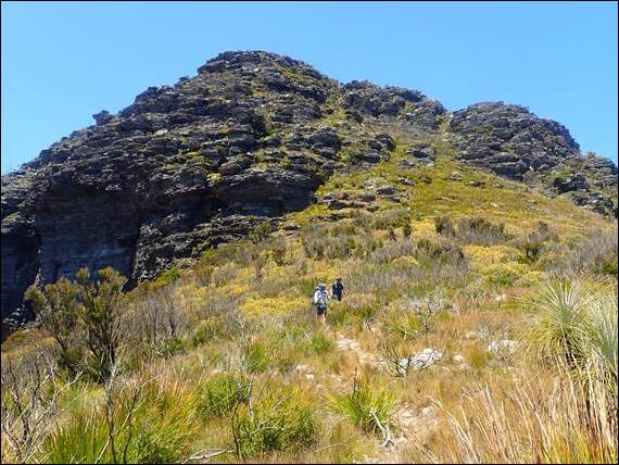
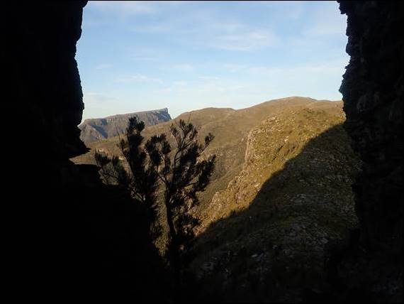
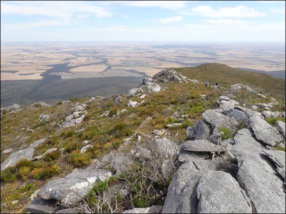
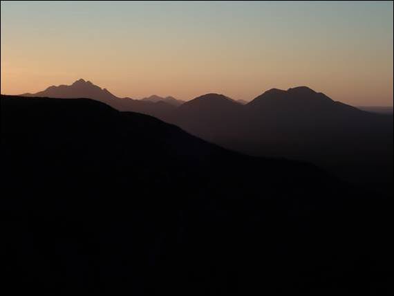
We made our way up the north peak of Isongerup, and from here we got to see the view of the western end of the Stirling Ranges stretching out beyond the unmistakeable 300m plus sheer face of the north face of Bluff Knoll. Way off in the distance familiar peaks of Toolbrunup, Mount Trio, Mount Hassel and others lay. While a very different landscape to what we had just come from, we equally enjoyed the change in pace and views. Everywhere we looked was a feast for our eyes:
On these more gentle slopes the weight of the pack didn’t seem to hang so heavy and I kept pace and we even swapped leads, as we moved on from the north peak to the true summit and then towards the south peak. Each peak being separated by a small saddle requiring a decent and ascent. Daz was feeling his knees on the descents. This was in part due to old injuries from a reckless youth spent on skateboards, but we also pondered whether his decision not to take up the offer of hiking poles may have been his undoing. Howsie and I had, like Alan, been converted they were very effective and useful:
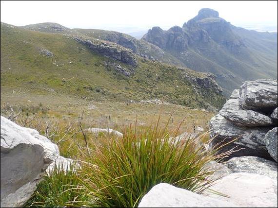
Above and from the top of the third and last peak of Isongerup we took our last close view of the rocky terrain of Ellen Peak, Pyungoorup, Bakers Knob and the three arrows. Still buzzing and all excited about where we had just come from. We then hiked down the western side of the south peak. A 200m decent on relatively steep ground, and Daz’s knees really felt it. Not only did his knees start to burn, but he also started to feel the sun more than we were. Both Howsie and I were well covered up, but Daz only had a T-shirt and despite lathering up with sun cream his arms were getting red:
Approx. two years back the park was ravaged by a massive bushfire, which I have mentioned in previous posts. On this walk we had passed a few cols, another word for saddle or the lowest point on a mountain ridge between two peaks. Some of these are marked up as good camping spots with higher vegetation that provide a degree of protection both from the sun and wind. The Sheoak col at the end of the arrows had faired quite well and here we found a couple of Irish guys who hadn’t even broken camp when we passed them, they were heading east and said their first day had been brutal. But like us they had covered almost half the distance in the first day:
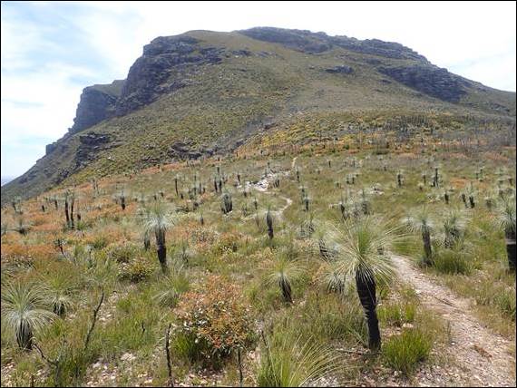
Sadly much of the vegetation had not fared so well. While, the dead looking trees and shrubs were coming back, and it has been a great winter for their recovery, they were growing back for the base and the foliage was at best shoulder height in most places. We were currently aiming for the Eucalypt col that lay just passed the slight bump in the ridge. This bump is the most undefined, and as such, smallest peak of the ridge but with the longest name of Moongoongoonderup. It was on the hike up this that I spotted the second and only flowering orchid I saw, a Scented Sun Orchid. Our plans were to rest up here, have lunch and take advantage of the whatever shade may have been on offer:
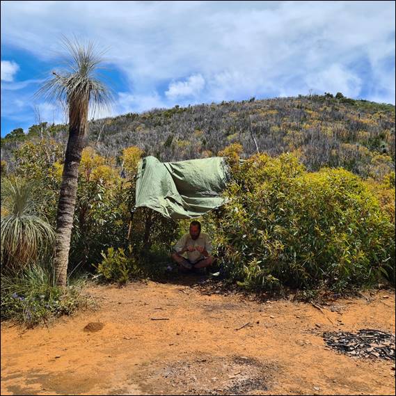
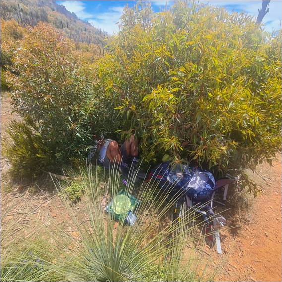
There was however very little shade. The sun was directly above us, being just past 11am, resulting in what little foliage there was being ineffective. Howsie used his tent to rig up some shade, while Daz opted for his sleeping bag. I found a suitable shrub and wormed my way in preferring to use nature to shade me, with just my feet sticking out. We had lunch and drank water, it was really hot and none of us were keen to continue on in the heat of the day. In fact this was the campsite we had initially considered aiming for today:
While we were here, a solo day walker came past having hiked from Bluff Knoll and continued past us after a brief chat. We all thought he was doing really well as he bounded off, but also recognised he only had a small 5kg day pack. Next up came a group of four, they were also heading eastwards and like us were eager for some shade. There had been none for them all day, and they looked hot and exhausted made all the worse with full packs being their first day. So our makeshift campsite grew, but for the most part everyone was quiet. The main talking point was that one of their party had blown a hiking shoe and their thong (flip-flop for non-Australians!):
Daz pulled out his cable ties and gaff tape, which he offered and was very grateful received to allow some essential shoe repairs to be made. The guy seemed confident they were fixed enough to keep moving onwards. The day walker came back as all six of us were in our make shift shelters, he was looking as spritely as he had the first time despite the heat. The group of four quizzed him and us about what lay ahead, and then after a good two hours of resting up they continued. As they walked off under hot sun heading for the Sheoak col, we wondered how the repairs would hold up on the rocky sections:
We hung about for maybe another hour. I had lain inside the vegetation for about four hours, snacking, sipping water and snoozing. It is a rare thing for me to stay still for such a long time, but the time seemed to go relatively quickly and none of us became fidgety. Other than when Daz jumped out of his shady spot due to a goanna deciding to snuggle up to him. Finally the heat seemed to die down and a breeze came in. We decided it was time to move on, aiming to get closer to the East Peak where we knew a 400m ascent awaited us. Something we wanted to tackle in first thing in the morning while our legs felt fresh and before it got hot:
Interestingly the crew of four had indicated Sunday would be cooler, maybe the forecast had changed since we had started our hike. But we were not chancing it, today was hot enough and if it got worse the 400m ascent in full sun would feel horrendous even in the morning. The maps and book doesn’t indicate there are any other campsites before the end, and neither the day walker nor the group of four said they saw anywhere to camp between where we were and the East Peak. But it would save an hour to an hour and half hiking up and down more slopes before the big hill, so all three of us were in agreeance that we should just do it:
Walking in the late afternoon, with a lighter pack after all the water we drank and cooler air was lovely. And we were rewarded with a choice of two campsites, big enough for the tent and my bivvy bag. We settled or a small cleared, flat and sandy patch nestled in a small area of vegetation. For this camp we didn’t see anyone else, and that made it feel that bit more special. While it was nice to see others out and about, enjoying this amazing hike, part of the thrill for us comes from being isolated. So having such a cool second campsite all to ourselves felt great:
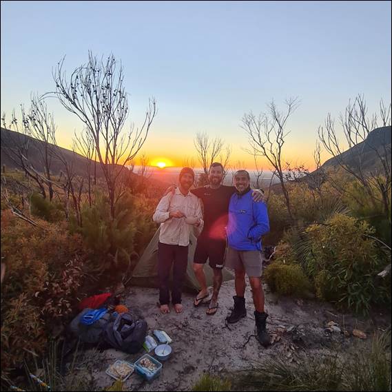
Once camp was set up we tucked into dinner, and there was still time to watch the sunset behind Bluff Knoll. Then as the darkness drew it’s cloak over us we settled in for the night. Unlike the night before there was not a cloud in sight and while the wind kicked up, we had just enough shelter to keep it at bay. With no cave roof above us, the wanning crescent moon was bright enough to make it had to determine when morning had truly arrived. I peeked out at some early hour to see a blanket of stars above, before zipping back up and snoozing until morning was really here. We were all up in time to watch the sunrise, and with no clouds about we knew the party of four had been misinformed and it would be a hot day:
Even though we set off at 5:30 it already felt warm, but fortunately it was a short ten to fifteen minutes to get to the base of the mighty ridge that takes you up to the East Peak. We had come up this far yesterday, but the second closer campsite option was rocky and probably more exposed with less vegetation. This short hike was however just enough to get the legs warmed up, ready for the main event. Also in our favour today we had rationalised water. We hadn’t thrown any away, but had drunk more and shared what remained between us. We were each only carrying 3 litres:
I estimated my pack had gone from 22kg to 13kg, no more than a climbing pack. And with such a light pack on my back I was ready for what looked like a typical scree slope ascent in the Lake District, one that Bob and I would have chewed up in an after work evening foray to some classic remote climb (https://sandbagged.blog/2017/08/13/part-5-the-lake-district-a-place-to-live/). In fact all three of us were excited by this climb, which probably says a lot about us and why everything between us just seemed easy on this trip:
One step at a time, and we all kept pace. A third of the way up I laughed out loud as I found the perfect shelf to camp on. We all stood there in disbelief at what we saw and even more so that none of the people from yesterday had noticed it. If someone had mentioned this place we would definitely have climbed up here just to experience camping on it. If we come back again this will definitely be a place I would consider camping at just for the pure exhilaration of the view and setting. Onwards we went and what the book indicated may take an hour and half, took us 45min. While the legs felt liked they had worked hard we were not huffing and puffing anywhere as much as previously:

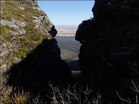
That was probably a good thing, as from the East Peak looking across to the East Bluff we could see the downs and ups were far from over. A great chasm splits the East Peak and Bluff and we had to make our way back away from the cliff faces into the top of a gully and then climb once more steeply up. Bluff Knoll stood there tantalising close, but still far enough away that we had to pace ourselves. As we descended off East Peak the wind really picked up and buffeted up through the chasm and at times we struggled to stay on our feet:
Battling the wind and slopes was almost comical, but none of us fell over although I’m not entirely sure how we managed to avoid it. Climbing up the others side it felt like this may have been the last real hurdle of steep ascents. We could tell we were getting back to more accessible terrain here, as we started to spot fenced off areas and in places individual plants were being protected by guards. But we didn’t spot to really inspect them. Despite the signs that indicated more people came this way the heat from above forced us to take our time, after all it only takes one silly slip for things to go south:
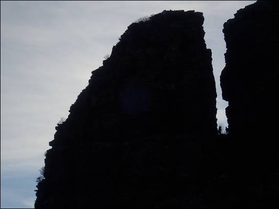
Just set back from the East Bluff is a large natural feature that looks just like a rock cairn or some may say a stack of pancakes. Two images above you may be able to make it out set on the downward slope of the ridge ahead. We had seen this way back on the hike and wondered what it was, a strange rock feature that possibly only nature will truly know why it is there. And probably just like everyone who comes to see it we couldn’t resist the ridge to climb up it:

I keep saying that Bluff Knoll was our destination, but in truth it was 3.5km from where we would be picked up. That lay 630m below the summit at the carpark, the biggest piece of infrastructure in the Stirling ranges. In fact most of this National Park is relatively untouched and still wilderness making it quite unique. Unencumbered by the safety requirements of modern day life that creep into many of these natural places, because people just can’t be trusted to be sensible:
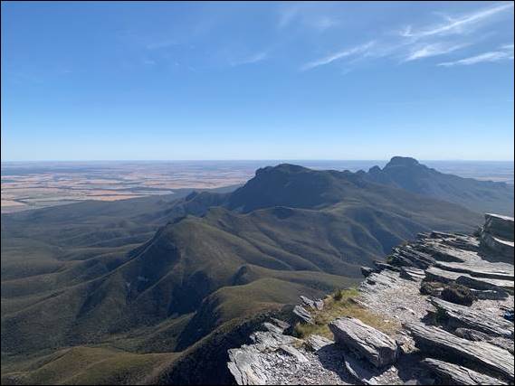
We made it to the summit of the highest peak in the Stirling Ranges in a little under two and a half hours after leaving camp. Standing at a lofty 1,099m but a mere 38m higher than the little known Pyungoorup. From the unfettered edge of the sheer 300m plus drop down the north face of Bluff Knoll we could see Pyungoorup. It’s towering height obscured any sight of Ellen Peak but we still had a spectacular view of almost the entire ridge walk. While the images still indicate we had the place to ourselves, we were now well and truly on the tourist track:
We snacked and drank, as people came and went. Eventually however the sand blasting we got, as the strong gusts of wind whistled up and over the vertical north face, made our minds up for us and we started the long descent. Being the tourist track it came with steps, the last thing our knees wanted. That said they are so important to control the erosion that some days will see literally thousands of footfalls. It was really hot now and as we came down still more people came up, most were dripping in sweat and it was hard to know if they were all enjoying themselves:

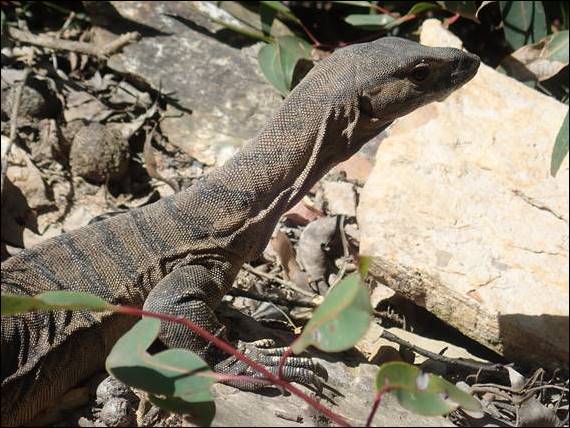
We later found out that today the forecast was 38 degrees, and it felt like it. We felt for those up on the ridge today, including two young guys we had met as they were walking up to start the ridge. Especially knowing they would have no shade all day. On the final stages we came across a Rosenberg’s Guanna (Varanus rosenbergi) and I seem to remember that Daz said it was one of these fellas that wanted to get all cosy with him at our lunchtime stop yesterday. We were a little surprised that on the whole trip we had only see two of these and two Bobtail Lizards (Tiliqua rugosa) and not one snake, which was a shame:
We sweltered into the shelter at the carpark at 9:30, and with such an early finish resulted in talk of getting back to the campsite freshening up and heading home today instead of tomorrow. Again, like it had been since the trip started, we were all on the same page. We glugged water waiting for our lift and watched more people only just starting their 3 to 4hr hike up and down Bluff Knoll in what I thought were silly conditions. Bully the driver rolled into the carpark, and on the drive back down we got talking orchids and he pointed to spots on the road where we might find particular species:
Needless to say we didn’t do back to check them out, instead when we got back we weighed our packs, showered, drank, ate, reorganised gear and got ready to head home. After the final leg during which we drank heaps of water, Daz and my pack came in about 10.5kg. Howsie’s was however still close to 12kg, not that it ever seemed to slow him down as he was ahead for most of the hike. Our last job before driving off was to head back to the National Park to sign out in the visitors book, and it was only then we realised that we had seven people on our tail that had also started from Ellen Peak on the same day. But even looking at the images we took I can’t find any trace of them. A humongous thanks to Howsie and Daz for allowing me to tag along, and also to Alan, Clint and Simon for the loan of gear and the lift:

